Tracing the Path of the 1915 Flood

To show the extent of the flood damage, in 1915, the Erie Daily Times sent its staff artist to the affected areas. On Aug. 6, 7 and 9, 1915; the Times published this block-by-block sketch showing the damage.
- The buildings shown in heavy black lines were washed away or demolished by the flood.
- The buildings in the light lines were damaged.
- The map shows the names of people who occupied the buildings, not necessarily the owners.
The map begins at 26th Street, between French and State, and ends at the Pennsylvania Railroad tracks, where Mill Creek empties into Presque Isle Bay.
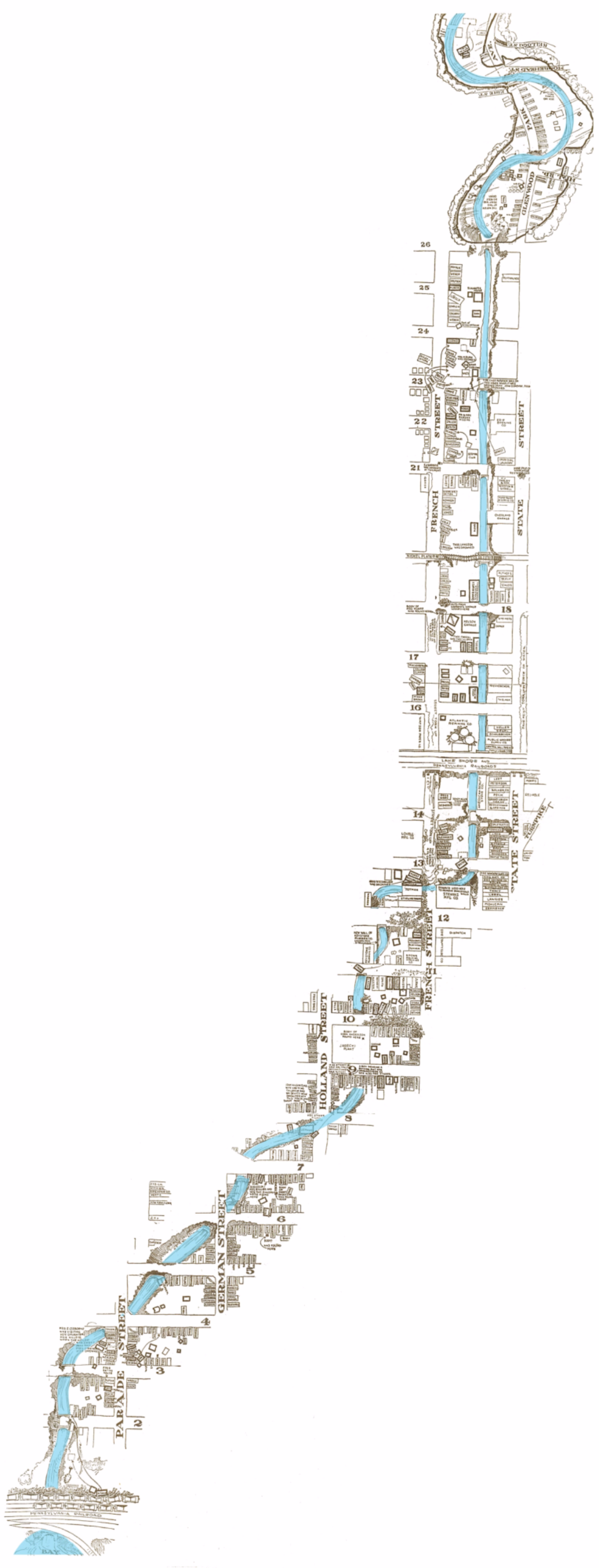
This information and map are from the August 3, 1990, Erie-Times News newspaper. The flood map was created in 1915.